
Pedrosa topographic map
Interactive map
Click on the map to display elevation.
About this map
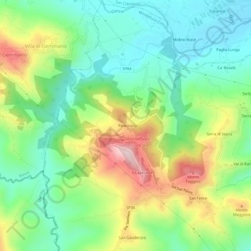
Name: Pedrosa topographic map, elevation, terrain.
Location: Pedrosa, RN, Emilia-Romaña, 47834, Italia (43.87285 12.58768 43.91285 12.62768)
Average elevation: 212 m
Minimum elevation: 72 m
Maximum elevation: 468 m