
Tongass National Forest topographic map
Interactive map
Click on the map to display elevation.
About this map
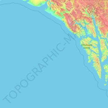
Name: Tongass National Forest topographic map, elevation, terrain.
Average elevation: 156 m
Minimum elevation: -4 m
Maximum elevation: 4,094 m
Historically, logging operations tended to concentrate on lower-elevation, bigger-tree ecosystems for harvesting; at present, approximately 78% of the land remains intact, i.e. 383,000 acres (1,550 km2) out of 491,000 acres (1,990 km2) original big-tree, low-elevation forest area. Given the high value of these areas for wildlife species, close to 70% of this old growth forest is protected in reserves and will never be eligible for harvest.
Other topographic maps
Click on a map to view its topography, its elevation and its terrain.
Clarence Kramer Peak
United States > Alaska > Sitka > Sitka
Clarence Kramer Peak, Sitka, Alaska, United States
Average elevation: 751 m
North Sister
United States > Alaska > Sitka > Sitka
North Sister, Sitka, Alaska, United States
Average elevation: 507 m
Beaver Lake
United States > Alaska > Sitka > Sitka
Beaver Lake, Sitka, Alaska, United States
Average elevation: 313 m
Fleming Island
United States > Alaska > Sitka
Fleming Island, Sitka, Alaska, United States
Average elevation: 149 m
Mount Edgecumbe
United States > Alaska > Sitka
Mount Edgecumbe, Sitka, Alaska, United States
Average elevation: 597 m