
เกาะช้าง topographic map
Interactive map
Click on the map to display elevation.
About this map
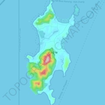
Name: เกาะช้าง topographic map, elevation, terrain.
Location: เกาะช้าง, จังหวัดระนอง, Thailand (9.78997 98.43097 9.87422 98.47143)
Average elevation: 14 m
Minimum elevation: 0 m
Maximum elevation: 368 m
Other topographic maps
Click on a map to view its topography, its elevation and its terrain.