
Langley topographic map
Interactive map
Click on the map to display elevation.
About this map
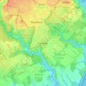
Name: Langley topographic map, elevation, terrain.
Average elevation: 18 m
Minimum elevation: -2 m
Maximum elevation: 37 m
Other topographic maps
Click on a map to view its topography, its elevation and its terrain.
Sutton
United Kingdom > England > Langley
Sutton, Langley, Cheshire East, North West England, England, United Kingdom
Average elevation: 267 m