
Stateline topographic map
Interactive map
Click on the map to display elevation.
About this map
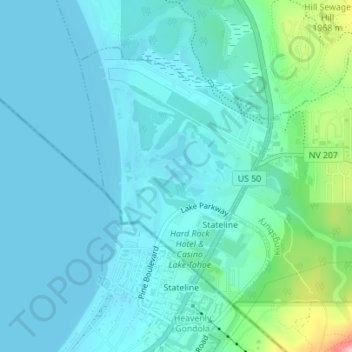
Name: Stateline topographic map, elevation, terrain.
Location: Stateline, Douglas County, Nevada, United States (38.95691 -119.95387 38.97666 -119.93495)
Average elevation: 1,922 m
Minimum elevation: 1,897 m
Maximum elevation: 2,053 m
Other topographic maps
Click on a map to view its topography, its elevation and its terrain.
Genoa
United States > Nevada > Douglas County > Genoa
Genoa, Douglas County, Nevada, 89411, United States
Average elevation: 1,687 m