
Fankerton topographic map
Interactive map
Click on the map to display elevation.
About this map
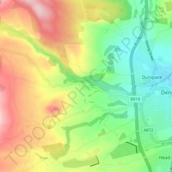
Name: Fankerton topographic map, elevation, terrain.
Location: Fankerton, Denny, Falkirk, Scotland, FK6 5HZ, United Kingdom (56.00517 -3.96279 56.04517 -3.92279)
Average elevation: 121 m
Minimum elevation: 32 m
Maximum elevation: 237 m