
Bangkal topographic map
Interactive map
Click on the map to display elevation.
About this map
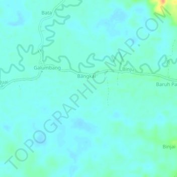
Name: Bangkal topographic map, elevation, terrain.
Location: Bangkal, South Kalimantan, Indonesia (-2.27848 115.59635 -2.23848 115.63635)
Average elevation: 31 m
Minimum elevation: 25 m
Maximum elevation: 62 m