
Tanjung Pandan topographic map
Interactive map
Click on the map to display elevation.
About this map
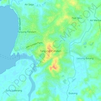
Name: Tanjung Pandan topographic map, elevation, terrain.
Average elevation: 9 m
Minimum elevation: -1 m
Maximum elevation: 43 m
Other topographic maps
Click on a map to view its topography, its elevation and its terrain.
Selat Nasik
Indonesia > Bangka-Belitung Islands > Belitung
Selat Nasik, Belitung, Bangka-Belitung Islands, Sumatra, Indonesia
Average elevation: 9 m