
Cottingham topographic map
Interactive map
Click on the map to display elevation.
About this map
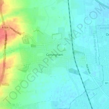
Name: Cottingham topographic map, elevation, terrain.
Average elevation: 13 m
Minimum elevation: -2 m
Maximum elevation: 55 m
Other topographic maps
Click on a map to view its topography, its elevation and its terrain.
Cottingham
United Kingdom > England > Cottingham
Cottingham, North Northamptonshire, East Midlands, England, LE16 8XL, United Kingdom
Average elevation: 97 m