
San Carlos topographic map
Interactive map
Click on the map to display elevation.
About this map
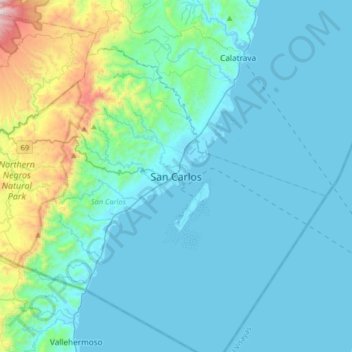
Name: San Carlos topographic map, elevation, terrain.
Average elevation: 164 m
Minimum elevation: -2 m
Maximum elevation: 1,244 m
Other topographic maps
Click on a map to view its topography, its elevation and its terrain.
San Carlos
Philippines > Negros Occidental > San Carlos
San Carlos, Negros Occidental, Western Visayas, 6127, Philippines
Average elevation: 190 m