
Taylors Falls topographic map
Interactive map
Click on the map to display elevation.
About this map
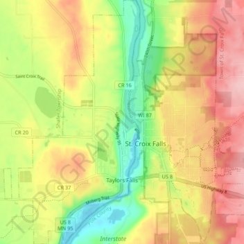
Name: Taylors Falls topographic map, elevation, terrain.
Location: Taylors Falls, Chisago County, Minnesota, United States (45.38678 -92.69236 45.44429 -92.64646)
Average elevation: 293 m
Minimum elevation: 206 m
Maximum elevation: 375 m