
Kanoneiland topographic map
Interactive map
Click on the map to display elevation.
About this map
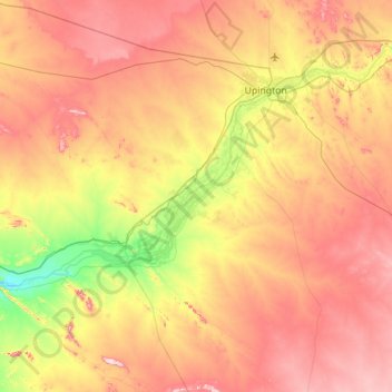
Name: Kanoneiland topographic map, elevation, terrain.
Average elevation: 858 m
Minimum elevation: 674 m
Maximum elevation: 1,043 m
Other topographic maps
Click on a map to view its topography, its elevation and its terrain.
Augrabies Falls
RSA > Northern Cape > Kai !Garib Local Municipality
Augrabies Falls, Kai !Garib Local Municipality, ZF Mgcawu District Municipality, Northern Cape, RSA
Average elevation: 618 m