
Kaesong topographic map
Interactive map
Click on the map to display elevation.
About this map
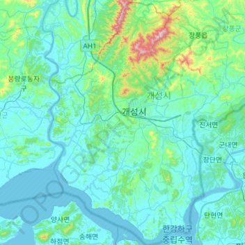
Name: Kaesong topographic map, elevation, terrain.
Location: Kaesong, Hwanghaebuk-do, North Korea (37.76196 126.38306 38.14446 126.74849)
Average elevation: 75 m
Minimum elevation: -3 m
Maximum elevation: 740 m
Other topographic maps
Click on a map to view its topography, its elevation and its terrain.
Koksan
North Korea > Hwanghaebuk-do > Koksan
Koksan, Koksan County, Hwanghaebuk-do, North Korea
Average elevation: 255 m