
River Drone topographic map
Interactive map
Click on the map to display elevation.
About this map
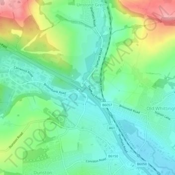
Name: River Drone topographic map, elevation, terrain.
Average elevation: 110 m
Minimum elevation: 65 m
Maximum elevation: 208 m
Other topographic maps
Click on a map to view its topography, its elevation and its terrain.
Duckmanton
United Kingdom > England > Chesterfield > Duckmanton
Duckmanton, Chesterfield, Derbyshire, East Midlands, England, S44 5EP, United Kingdom
Average elevation: 82 m
Staveley CP
United Kingdom > England > Chesterfield
Staveley CP, Chesterfield, Derbyshire, East Midlands, England, United Kingdom
Average elevation: 86 m
River Hipper
United Kingdom > England > Chesterfield
River Hipper, Chesterfield, Derbyshire, East Midlands, England, S41 7RS, United Kingdom
Average elevation: 100 m