
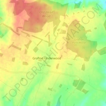
Grafton Underwood topographic map
Interactive map
Click on the map to display elevation.
About this map
Name: Grafton Underwood topographic map, elevation, terrain.
Average elevation: 95 m
Minimum elevation: 63 m
Maximum elevation: 120 m
Other topographic maps
Click on a map to view its topography, its elevation and its terrain.
Kettering
United Kingdom > England > Kettering
Kettering, Northamptonshire, East Midlands, England, NN16 8SX, United Kingdom
Average elevation: 92 m
Pipewell
United Kingdom > England > Kettering > Pipewell
Pipewell, Rushton, Kettering, Northamptonshire, East Midlands, England, NN14 1QZ, United Kingdom
Average elevation: 124 m
Mawsley
United Kingdom > England > Kettering
Mawsley, Kettering, Northamptonshire, East Midlands, England, United Kingdom
Average elevation: 132 m
Pytchley
United Kingdom > England > Kettering
Pytchley, Kettering, Northamptonshire, East Midlands, England, United Kingdom
Average elevation: 96 m