
Dikhil topographic map
Interactive map
Click on the map to display elevation.
About this map
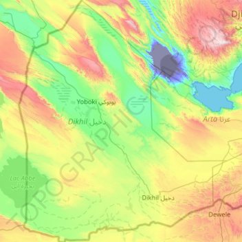
Name: Dikhil topographic map, elevation, terrain.
Location: Dikhil, Djibouti (10.91495 41.77131 11.93207 42.66610)
Average elevation: 484 m
Minimum elevation: -154 m
Maximum elevation: 1,776 m
Other topographic maps
Click on a map to view its topography, its elevation and its terrain.