
Lick Creek Park topographic map
Interactive map
Click on the map to display elevation.
About this map
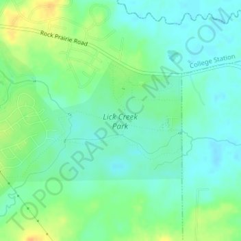
Name: Lick Creek Park topographic map, elevation, terrain.
Average elevation: 70 m
Minimum elevation: 59 m
Maximum elevation: 88 m
Other topographic maps
Click on a map to view its topography, its elevation and its terrain.
Wicker
United States > Texas > Brazos County > College Station
Wicker, College Station, Brazos County, Texas, 77881, United States
Average elevation: 94 m
Research Park
United States > Texas > Brazos County > College Station
Research Park, College Station, Brazos County, Texas, United States
Average elevation: 100 m