
Carrè topographic map
Interactive map
Click on the map to display elevation.
About this map
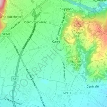
Name: Carrè topographic map, elevation, terrain.
Location: Carrè, VI, Veneto, 36010, Italia (45.72923 11.43747 45.75724 11.50254)
Average elevation: 234 m
Minimum elevation: 154 m
Maximum elevation: 486 m