
Guzeripl topographic map
Interactive map
Click on the map to display elevation.
About this map
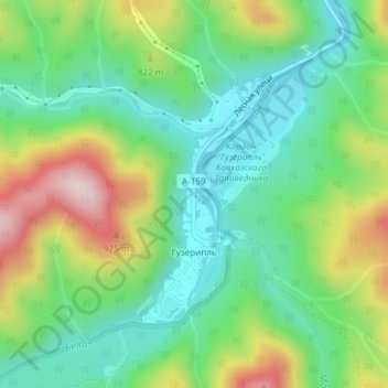
Name: Guzeripl topographic map, elevation, terrain.
Average elevation: 778 m
Minimum elevation: 653 m
Maximum elevation: 1,011 m
Other topographic maps
Click on a map to view its topography, its elevation and its terrain.
Ассара
Russia > Republic of Adygea > Maykopsky District
Ассара, Даховское сельское поселение, Maykopsky District, Republic of Adygea, Southern Federal District, Russia
Average elevation: 2,229 m
Maykopsky District
Russia > Republic of Adygea > Maykopsky District
Maykopsky District, Republic of Adygea, Southern Federal District, Russia
Average elevation: 785 m