
Großer Berg topographic map
Interactive map
Click on the map to display elevation.
About this map
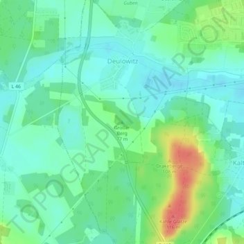
Name: Großer Berg topographic map, elevation, terrain.
Location: Großer Berg, Guben, Spree-Neiße, Brandenburg, 03172, Germany (51.93827 14.65133 51.93837 14.65143)
Average elevation: 62 m
Minimum elevation: 44 m
Maximum elevation: 107 m
Other topographic maps
Click on a map to view its topography, its elevation and its terrain.
Pusch
Germany > Brandenburg > Guben
Pusch, Guben, Spree-Neiße, Brandenburg, Germany
Average elevation: 52 m