
Snaefell topographic map
Interactive map
Click on the map to display elevation.
About this map
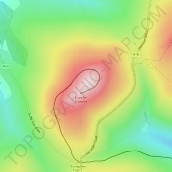
Name: Snaefell topographic map, elevation, terrain.
Location: Snaefell, Lezayre, Ayre, Isle of Man (54.26319 -4.46172 54.26329 -4.46162)
Average elevation: 391 m
Minimum elevation: 202 m
Maximum elevation: 619 m
Other topographic maps
Click on a map to view its topography, its elevation and its terrain.
Yellow Stone
Isle of Man > Ayre > Lezayre
Yellow Stone, Lezayre, Ayre, IM4 7NY, Isle of Man
Average elevation: 407 m