
Village of Horseheads topographic map
Interactive map
Click on the map to display elevation.
About this map
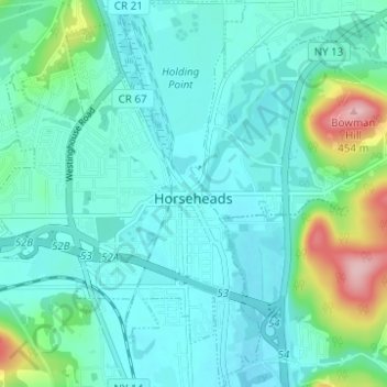
Name: Village of Horseheads topographic map, elevation, terrain.
Average elevation: 298 m
Minimum elevation: 263 m
Maximum elevation: 454 m
Other topographic maps
Click on a map to view its topography, its elevation and its terrain.
Brand Park
United States > New York > Chemung County > City of Elmira
Brand Park, City of Elmira, Chemung County, New York, United States
Average elevation: 270 m
City of Elmira
United States > New York > Chemung County > City of Elmira
City of Elmira, Ashland, Chemung County, New York, United States
Average elevation: 296 m
Village of Millport
United States > New York > Chemung County
Village of Millport, Town of Veteran, Chemung County, New York, United States
Average elevation: 296 m
Langdon Hill
United States > New York > Chemung County
Langdon Hill, Chemung County, New York, 14838, United States
Average elevation: 449 m
Lowman
United States > New York > Chemung County
Lowman, Town of Ashland, Chemung County, New York, 14894, United States
Average elevation: 290 m