
Rošpoh topographic map
Interactive map
Click on the map to display elevation.
About this map
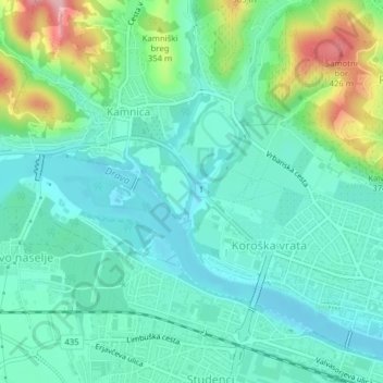
Name: Rošpoh topographic map, elevation, terrain.
Location: Rošpoh, Maribor, 2351, Slovenia (46.56433 15.61690 46.57034 15.62017)
Average elevation: 297 m
Minimum elevation: 253 m
Maximum elevation: 429 m
Other topographic maps
Click on a map to view its topography, its elevation and its terrain.
Mestni park
Mestni park, Ribniško selo, Maribor, 2000, Slovenia
Average elevation: 303 m