
Bridge of Don topographic map
Interactive map
Click on the map to display elevation.
About this map
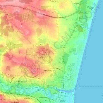
Name: Bridge of Don topographic map, elevation, terrain.
Location: Bridge of Don, Aberdeen City, Scotland, United Kingdom (57.17175 -2.15474 57.22744 -2.05912)
Average elevation: 47 m
Minimum elevation: -2 m
Maximum elevation: 102 m
Scotland trails, hiking, mountain biking, running and outdoor activities
Other topographic maps
Click on a map to view its topography, its elevation and its terrain.
Brimmond Hill
United Kingdom > Scotland > Aberdeen City
Brimmond Hill is a hill in Aberdeen, Scotland. The summit is the highest point within the Aberdeen City council area, at an elevation of 266 m (873 ft).
Average elevation: 165 m