
Lummus Park topographic map
Interactive map
Click on the map to display elevation.
About this map
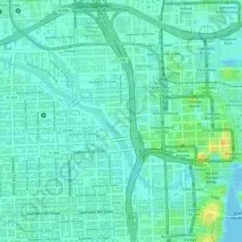
Name: Lummus Park topographic map, elevation, terrain.
Location: Lummus Park, Miami, Miami-Dade County, Florida, USA (25.77569 -80.20267 25.77678 -80.20016)
Average elevation: 10 m
Minimum elevation: -5 m
Maximum elevation: 36 m
Other topographic maps
Click on a map to view its topography, its elevation and its terrain.
The Barnacle Historic State Park
The Barnacle Historic State Park, 3485, Dinner Key, Miami, Miami-Dade County, Florida, USA
Average elevation: 7 m