
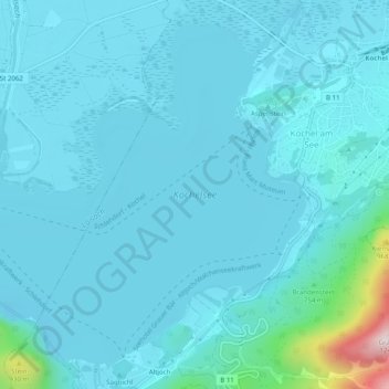
Kochelsee topographic map
Interactive map
Click on the map to display elevation.
About this map
Name: Kochelsee topographic map, elevation, terrain.
Average elevation: 641 m
Minimum elevation: 586 m
Maximum elevation: 1,184 m
Other topographic maps
Click on a map to view its topography, its elevation and its terrain.
Walchensee
Germany > Bavaria > Kochel am See
Walchensee, Kirchelwandtunnel, Kochel am See, Kochel am See (VGem), Landkreis Bad Tölz-Wolfratshausen, Upper Bavaria, Bavaria, 82432, Germany
Average elevation: 937 m