
La Sengla topographic map
Interactive map
Click on the map to display elevation.
About this map
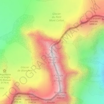
Name: La Sengla topographic map, elevation, terrain.
Location: La Sengla, Bionaz, Valle d'Aosta, Italia (45.94633 7.47175 45.94643 7.47185)
Average elevation: 3,147 m
Minimum elevation: 2,586 m
Maximum elevation: 3,686 m
Other topographic maps
Click on a map to view its topography, its elevation and its terrain.