
Kampinos topographic map
Interactive map
Click on the map to display elevation.
About this map
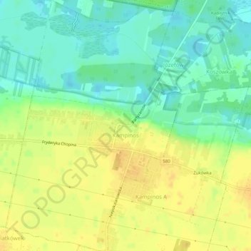
Name: Kampinos topographic map, elevation, terrain.
Average elevation: 80 m
Minimum elevation: 66 m
Maximum elevation: 91 m
Other topographic maps
Click on a map to view its topography, its elevation and its terrain.
Błonie
Poland > Masovian Voivodeship > Warsaw West County
Błonie, gmina Błonie, Warsaw West County, Masovian Voivodeship, Poland
Average elevation: 90 m
Truskaw
Poland > Masovian Voivodeship > Warsaw West County
Truskaw, gmina Izabelin, Warsaw West County, Masovian Voivodeship, Poland
Average elevation: 82 m