
Burdaard topographic map
Interactive map
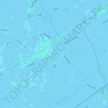
Click on the map to display elevation.
About this map
Name: Burdaard topographic map, elevation, terrain.
Average elevation: 0 m
Minimum elevation: -3 m
Maximum elevation: 3 m
Alongside the two existent major terpen, there were four minor terpen that are now (almost) completely gone or hard to recognize as a terp nowadays. The Terp Baerd was situated north of the village, just south of the Iedyk road. It was demolished completely in the second half of the 19th century, leaving a small wetland area that is at a lower elevation than the surrounding farmland. Nowadays it is only recognizable in satellite pictures and in the jagged borders of the surrounding fields. The Terp van Kolkhuizen suffered the same fate, and is even harder to recognize nowadays. Another terp, the Terp met de Reamskûtel, is mostly intact, but is not very recognizable, due to its low height. It has just one farmhouse. During construction work in 1998, the site was excavated, and small shells in the layers of soil below the oldest part of the mound were dated to approximately 500 BC, meaning the Terp van Kolkhuizen (and almost certainly other mounds in the surrounding region as well) has been inhabited since at least that time period. The fourth minor terp, the Wierde van Hollebrantsje, is nowadays only visible as a slight difference in elevation.
Other topographic maps
Click on a map to view its topography, its elevation and its terrain.
Noardeast-Fryslân
The Netherlands > Friesland > Noardeast-Fryslân
Noardeast-Fryslân, Friesland, Netherlands, The Netherlands
Average elevation: 0 m