
Saint Mary topographic map
Interactive map
Click on the map to display elevation.
About this map
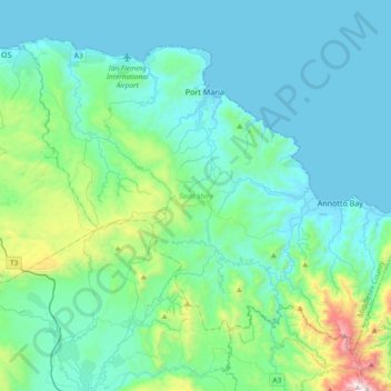
Name: Saint Mary topographic map, elevation, terrain.
Location: Saint Mary, Middlesex County, Jamaika (18.14496 -77.07221 18.42414 -76.69944)
Average elevation: 211 m
Minimum elevation: 0 m
Maximum elevation: 1,412 m
Other topographic maps
Click on a map to view its topography, its elevation and its terrain.