
Saint Thomas topographic map
Interactive map
Click on the map to display elevation.
About this map
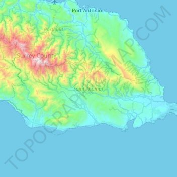
Name: Saint Thomas topographic map, elevation, terrain.
Location: Saint Thomas, Surrey County, Jamaika (17.85024 -76.66565 18.09287 -76.18296)
Average elevation: 245 m
Minimum elevation: -2 m
Maximum elevation: 2,230 m
Other topographic maps
Click on a map to view its topography, its elevation and its terrain.