
Hanover topographic map
Interactive map
Click on the map to display elevation.
About this map
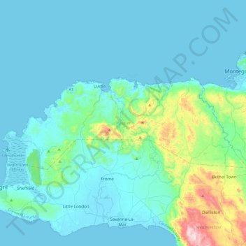
Name: Hanover topographic map, elevation, terrain.
Location: Hanover, Cornwall County, Jamaika (18.30720 -78.34505 18.46281 -77.90973)
Average elevation: 93 m
Minimum elevation: -1 m
Maximum elevation: 782 m
Other topographic maps
Click on a map to view its topography, its elevation and its terrain.