
Ashdown topographic map
Interactive map
Click on the map to display elevation.
About this map
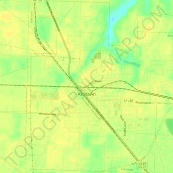
Name: Ashdown topographic map, elevation, terrain.
Location: Ashdown, Little River County, Arkansas, 71822, United States (33.65302 -94.14909 33.69759 -94.09672)
Average elevation: 101 m
Minimum elevation: 84 m
Maximum elevation: 106 m
Other topographic maps
Click on a map to view its topography, its elevation and its terrain.