
Wauwatosa topographic map
Interactive map
Click on the map to display elevation.
About this map
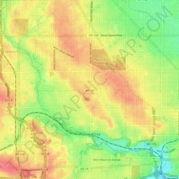
Name: Wauwatosa topographic map, elevation, terrain.
Location: Wauwatosa, Milwaukee County, Wisconsin, United States (43.03092 -88.06703 43.10442 -87.98397)
Average elevation: 220 m
Minimum elevation: 183 m
Maximum elevation: 251 m
Other topographic maps
Click on a map to view its topography, its elevation and its terrain.