
Villamaría topographic map
Interactive map
Click on the map to display elevation.
About this map
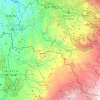
Name: Villamaría topographic map, elevation, terrain.
Location: Villamaría, Centrosur, Caldas, Colombia (4.80251 -75.58937 5.05226 -75.31738)
Average elevation: 2,403 m
Minimum elevation: 1,060 m
Maximum elevation: 4,785 m