
Gazzola topographic map
Interactive map
Click on the map to display elevation.
About this map
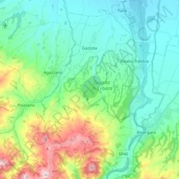
Name: Gazzola topographic map, elevation, terrain.
Location: Gazzola, Piacenza, Emilia-Romagna, Italy (44.88526 9.49701 44.98915 9.59535)
Average elevation: 218 m
Minimum elevation: 88 m
Maximum elevation: 617 m