
Talaga Port topographic map
Interactive map
Click on the map to display elevation.
About this map
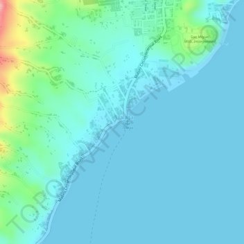
Name: Talaga Port topographic map, elevation, terrain.
Location: Talaga Port, Mabini, Batangas, Calabarzon, 4202, Philippines (13.73318 120.93566 13.73328 120.93576)
Average elevation: 22 m
Minimum elevation: 0 m
Maximum elevation: 133 m