
Thiririka River topographic map
Interactive map
Click on the map to display elevation.
About this map
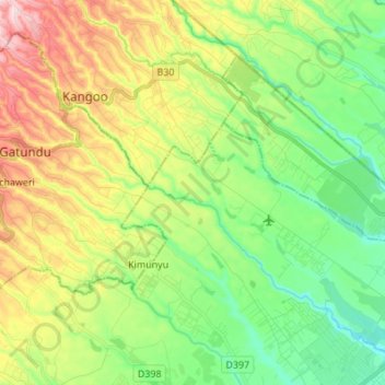
Name: Thiririka River topographic map, elevation, terrain.
Location: Thiririka River, Kiambu County, Central Kenya, 01030, Kenya (-1.08762 36.90040 -0.97304 37.03663)
Average elevation: 1,588 m
Minimum elevation: 1,479 m
Maximum elevation: 1,773 m
Other topographic maps
Click on a map to view its topography, its elevation and its terrain.
Githunguri
Kenya > Kiambu County > Githunguri
Githunguri, Kiambu County, Central Kenya, Kenya
Average elevation: 1,930 m
Kamwangi
Kenya > Kiambu County > Kamwangi
Kamwangi, Kiambu County, Central Kenya, Kenya
Average elevation: 1,746 m