
Silver Lake topographic map
Interactive map
Click on the map to display elevation.
About this map
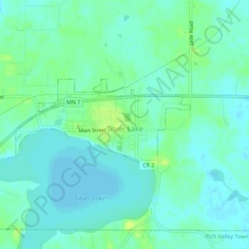
Name: Silver Lake topographic map, elevation, terrain.
Location: Silver Lake, McLeod County, Minnesota, United States (44.89873 -94.21225 44.90865 -94.18552)
Average elevation: 320 m
Minimum elevation: 314 m
Maximum elevation: 330 m
Other topographic maps
Click on a map to view its topography, its elevation and its terrain.
Glencoe
United States > Minnesota > McLeod County
Glencoe, McLeod County, Minnesota, United States
Average elevation: 309 m
Plato
United States > Minnesota > McLeod County > Plato
Plato, McLeod County, Minnesota, United States
Average elevation: 303 m