
Staffanstorps kommun topographic map
Interactive map
Click on the map to display elevation.
About this map
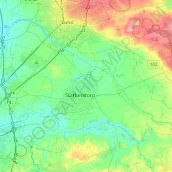
Name: Staffanstorps kommun topographic map, elevation, terrain.
Location: Staffanstorps kommun, Skåne County, Region Götaland, Sweden (55.59488 13.10373 55.70532 13.35473)
Average elevation: 29 m
Minimum elevation: -1 m
Maximum elevation: 101 m
Other topographic maps
Click on a map to view its topography, its elevation and its terrain.