
Lavasan topographic map
Interactive map
Click on the map to display elevation.
About this map
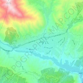
Name: Lavasan topographic map, elevation, terrain.
Location: Lavasan, مرز شهر لواسان, Shemiranat County, 3341681979, Iran (35.78048 51.59214 35.86048 51.67214)
Average elevation: 1,900 m
Minimum elevation: 1,530 m
Maximum elevation: 2,955 m