
Bet Shemesh topographic map
Interactive map
Click on the map to display elevation.
About this map
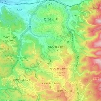
Name: Bet Shemesh topographic map, elevation, terrain.
Location: Bet Shemesh, Jerusalem District, 9901312, Israel (31.69402 34.95110 31.75806 35.00797)
Average elevation: 321 m
Minimum elevation: 164 m
Maximum elevation: 549 m