
Bradfordville topographic map
Interactive map
Click on the map to display elevation.
Bradfordville
Bradfordville is an unincorporated community in northern Leon County, Florida, United States. It is 8 miles (13 km) north of Tallahassee and south of the Florida/Georgia state line by 8 miles (13 km) at the intersection of US 319 and County Road 0342 (Bannerman Road/Bradfordville Road). Elevation is 237 feet (72 m).
About this map
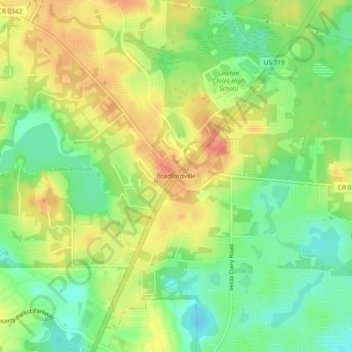
Name: Bradfordville topographic map, elevation, terrain.
Average elevation: 51 m
Minimum elevation: 25 m
Maximum elevation: 78 m