
Upplands Väsby kommun topographic map
Click on the map to display elevation.
Gear up for your next adventure:
As an Amazon Associate, this site earns from qualifying purchases at no extra cost to you.
About this map
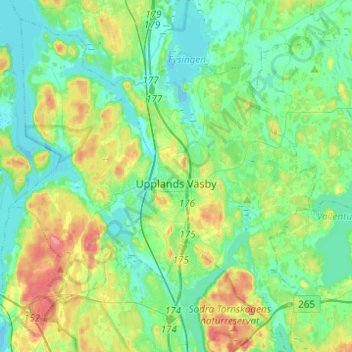
Name: Upplands Väsby kommun topographic map, elevation, terrain.
Location: Upplands Väsby kommun, Stockholm County, Sweden (59.45732 17.79932 59.58215 18.04414)
Average elevation: 20 m
Minimum elevation: -7 m
Maximum elevation: 68 m
Other topographic maps
Click on a map to view its topography, its elevation and its terrain.