
Coalbrookdale topographic map
Interactive map
Click on the map to display elevation.
About this map
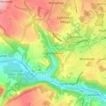
Name: Coalbrookdale topographic map, elevation, terrain.
Average elevation: 130 m
Minimum elevation: 38 m
Maximum elevation: 231 m
Telford and Wrekin trails, hiking, mountain biking, running and outdoor activities
Other topographic maps
Click on a map to view its topography, its elevation and its terrain.
Shropshire Union Canal Newport Branch
United Kingdom > England > Telford and Wrekin > Newport
Average elevation: 77 m
Shropshire Union Canal Newport Branch
United Kingdom > England > Telford and Wrekin > Newport
Average elevation: 76 m