Geolocate

Fall Creek topographic map

Interactive map

Click on the map to display elevation.

About this map

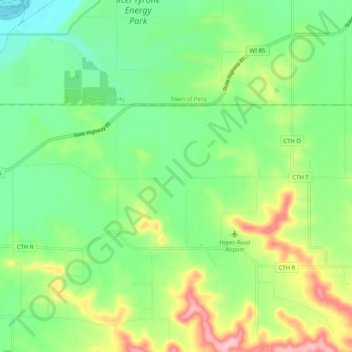
Name: Fall Creek topographic map, elevation, terrain.

Location: Fall Creek, Town of Lima, Pepin County, Wisconsin, United States of America (44.63289 -91.86850 44.70522 -91.77283)

Average elevation: 271 m

Minimum elevation: 214 m

Maximum elevation: 376 m

Other topographic maps

Click on a map to view its topography, its elevation and its terrain.

Elcho

United States of America > Wisconsin > Elcho

Average elevation: 500 m

Mindoro

United States of America > Wisconsin > Mindoro

Average elevation: 267 m

Barnum

United States of America > Wisconsin > Barnum

Average elevation: 264 m

Bayfield

United States of America > Wisconsin

Average elevation: 324 m

Salem

United States of America > Wisconsin > Salem

Average elevation: 300 m