
Gemeinde Warth topographic map
Interactive map
Click on the map to display elevation.
About this map
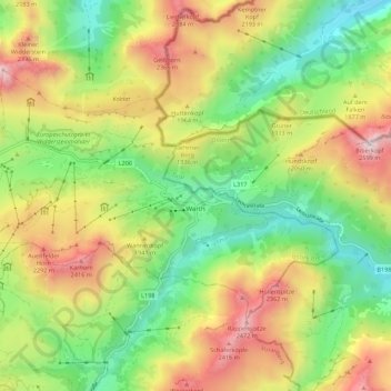
Name: Gemeinde Warth topographic map, elevation, terrain.
Location: Gemeinde Warth, Bezirk Bregenz, Vorarlberg, 6767, Austria (47.23661 10.11366 47.28468 10.22361)
Average elevation: 1,799 m
Minimum elevation: 1,274 m
Maximum elevation: 2,526 m