
Streetman topographic map
Interactive map
Click on the map to display elevation.
About this map
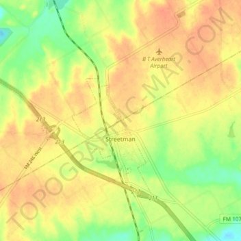
Name: Streetman topographic map, elevation, terrain.
Location: Streetman, Freestone County, Texas, United States of America (31.85893 -96.38349 31.90505 -96.30889)
Average elevation: 113 m
Minimum elevation: 88 m
Maximum elevation: 129 m