
Mangaia topographic map
Interactive map
Click on the map to display elevation.
About this map
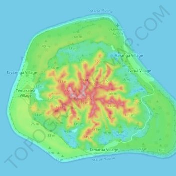
Name: Mangaia topographic map, elevation, terrain.
Location: Mangaia, Cook Islands (-21.95921 -157.96148 -21.89084 -157.87441)
Average elevation: 38 m
Minimum elevation: 0 m
Maximum elevation: 181 m