
Anjouan topographic map
Interactive map
Click on the map to display elevation.
About this map
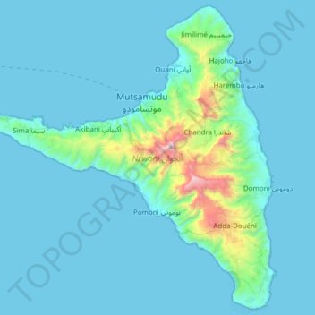
Name: Anjouan topographic map, elevation, terrain.
Location: Anjouan, Comoros (-12.38495 44.20478 -12.06821 44.54064)
Average elevation: 133 m
Minimum elevation: 0 m
Maximum elevation: 1,568 m
Other topographic maps
Click on a map to view its topography, its elevation and its terrain.